The New York City Council voted to approve the East Side Coastal Resiliency (ESCR) Project yesterday, with little opposition from officials. Local councilwoman Margaret Chin, who represents the affected area, fell in favor of the $1.45 billion project, which will raise East River Park to 8- to-10 feet above sea level with landfill from Montgomery Street to 25th street to protect against future floods. Forty-six members voted in favor, with only one against and one abstention, and the plan now only has to cross Mayor de Blasio’s desk, and he’s indicated that he’ll sign it.
The project has experienced strong ongoing opposition from organized community groups, civic associations, and neighborhood parks advocates, who voiced opposition to the extended loss of play areas, removal of trees, and lack of consultation during the design process. A coalition of community groups had drafted an alternative People’s Plan, which the final project considered as a part of its community engagement, along with the EDC’s Waterfront Esplanade plan and WXY Studio’s East River Blueway Plan. The city responded with a plan to phase work over a longer period to ensure the availability of parks during the construction.
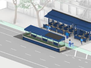
Others, like architect William Rockwell, who lives in an Amalgamated Dwellings Cooperative building and experienced severe flooding and loss of power during Hurricane Sandy in 2012, voiced support. Among the notable benefits of the design, apart from potentially live-saving flood protection, will be vastly improved pedestrian connections to the East River across on grade bridges spanning FDR Drive.

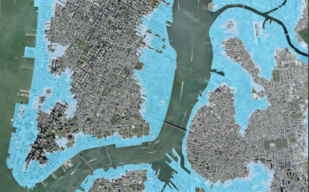
The areas protected from flooding, according to the Scope of Work in the Environmental Impact Statement, fall within the 100-year flood zone and extend upland to meet the 90th percentile projection of sea-level rise to the 2050s. That includes large parts of the Lower East Side and East Village, Stuy Town, Peter Cooper Village, and Stuyvesant Cove Park, which was built on top of low-lying marshes.

Originated in the aftermath of Hurricane Sandy as part of the BIG U Rebuild by Design project—with Bjarke Ingels Group as the lead urban designer in collaboration with One Architecture, Starr Whitehouse, James Lima Planning + Development, Green Shield Ecology, AEA Consulting, Level Agency for Infrastructure, ARCADIS, and Buro Happold—the ESCR became the northern half of two separate projects, with the other part section, the Lower Manhattan Coastal Resiliency Project, extending below the Manhattan bridge.
The U.S. Department of Housing and Urban Development originally committed $511 million to the project during the Rebuild by Design phase, with New York promising an additional $305 million. The environmental impact statement (EIS), however, only cites the $1.45 billion cost and $335 million committed by HUD from a federal Community Development Block Grant.
An October 2019 independent review of the ESCR by the U.S. arm of Dutch water research institute Deltares noted the lack of publicly available information on aspects of the project, making it impossible to review in its totality. The report argues that “transparency of the decision-making process by city agencies will help rebuild trust and gain [the] support of the community,” and recommended establishing a community advisory group and keeping community representatives involved in the later, more detailed stages of project design. It also recommended adding two more feet of fill, coordinating with the green infrastructure program, and studying groundwater patterns in the East Village to evaluate the impact of rainfall on the neighborhood and basement flooding. The implementation is being led by the New York City Department of Design and Construction with AKRF/KSE Engineering as the lead consultant.