Gowanus, the Brooklyn neighborhood known for its namesake toxic canal (which is prone to flooding), will be joining Manhattan’s Garment District as the next neighborhood to be rezoned.
Following over 100 hours of community outreach after the release of the original Gowanus PLACES Study in 2016, the Department of City Planning (DCP) has unveiled the Draft Framework for a Sustainable, Inclusive, Mixed-use Neighborhood. The 188-page draft breaks down suggestions from the city and community on how to boost the neighborhood’s resiliency, replace some of the manufacturing areas with residential, and build up flood-resistant infrastructure. New York City Housing Authority (NYCHA) tenants were also consulted on how to improve the area’s public housing stock moving forward.
Surprising no one, a great deal of attention was paid towards the future of the Gowanus Canal proper. Plans for dredging and remediating the industrial waterway (despite the preservation concerns), preventing runoff from reaching the canal, and incentivizing private residences to remediate their contaminated sites were given top billing.
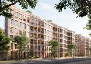
Despite the fetid waters, Gowanus has seen an upsurge in luxury development in recent years (including Brooklyn’s first Whole Foods, on 3rd Avenue). The city worked with community groups such as Bridging Gowanus to develop guides for building affordably in the neighborhood. Some of those proposals include rezoning the majority industrial and commercial neighborhood to allow for mid-rise residential developments with a sizeable affordable housing component.
While nods were given to reigning in development along mid-block properties, the city has proposed allowing higher-density developments along certain stretches, such as near Thomas Greene Playground and on 3rd Avenue.
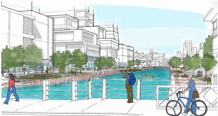
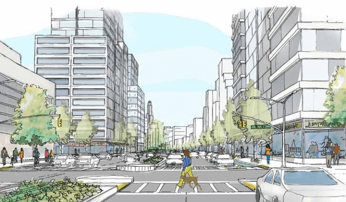
Some of the beefier urbanist proposals in the draft framework include bridging non-contiguous plots into walkable “superblocks,” and the creation of a unified waterfront esplanade around the canal under a Waterfront Access Plan (WAP). The WAP would also create uniformly-spaced canal crossings, new flood resistance requirements, ground-floor retail requirements along the waterfront, and lowered street wall heights on the coast. The full draft framework plan can be found here.
The framework’s release will be followed by the Draft Neighborhood Plan and Zoning Proposal this winter, and then the rezoning proposal will move to the Uniform Land Use Review Procedure (ULURP) for public comment. Interested community members can attend an open house at P.S. 32 at 317 Hoyt Street on June 27 from 5 to 8:30 P.M. to share their feedback.