A familiar narrative of urban change is playing out in what one clickbait article after another deems “the world’s coolest neighborhood”: Naive hipster newcomers, purveyors of mallcore architecture, and real estate speculators are descending on Bushwick, Brooklyn, raising rents and displacing the longtime Latino community.
This time, Local group NORTH WEST BUSHWICK COMMUNITY is fighting back, with maps.
The group, a coalition of neighborhood activists, recently launched the North West Bushwick Community Map, an online tool that shares urban planning and housing data with residents and activists to mobilize against the twin forces of gentrification and displacement.
The map depicts an area roughly bounded by Flushing Avenue to the east; Cypress Avenue to the north; Cemetery of the Evergreens to the west; and Broadway to the south. Over the base map, users can toggle between six layers that reveal patterns of development and residential stability: Tax Lots, Year Built, Land Use, Vacant Land, Available FAR, and Likely Rent Stabilized. There’s an overlay that depicts “DOB Jobs” in two categories—new buildings and A1 (major alterations)—as well as one that shares “Sites of Gentrification.” Also included are three interviews with a longtime artist-resident (link was dead at press time); an organizer with Make the Road, and a co-founder of Silent Barn, the beloved DIY venue-slash-community space.
Like all maps, this one richly illustrates its makers’ outlook and objectives, explicitly and by omission. Average rents in Bushwick have increased six percent over last year, and the group takes a decidedly dim view of the landlords and real estate actors that affect change in the neighborhood. Gentrification and displacement are “urban vices,” which lends a moral imperative to the map—housing as a human right. The creators note that investors and real estate agents use “costly websites” to search for properties and that Bushwick, consequently, needed a free map to chart—and combat—changes. (It’s not clear if this map could be a boon for investors, as its wealth of granular information could be used to pinpoint particularly vulnerable blocks, for example.)
AN reached out to NORTH WEST BUSHWICK COMMUNITY for comment, but a representative from the group could not be reached at press time.
According to the group’s site, beta testing for the map launched in 2014, and the final version debuted at an August 25 launch party. The map key states that many residents are not aware that they may be living in rent-stabilized units, which comprise almost one-third of Bushwick’s housing stock, or that there is legal recourse for fighting shady landlords who push out rent-stabilized tenants to score a vacancy increase. Community organizers who fight displacement can use the map to pinpoint housing trends and focus their efforts accordingly.
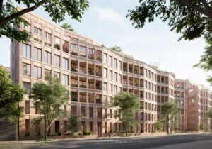
Through the “Sites of Gentrification” tab, the map highlights recent struggles over zoning and development at Colony 1209, a development where studios rent for close to $1900 per month; and at the former Rheingold Brewery, which ODA is redeveloping as a one-million-square-foot “European Village.” The “Research” tab includes helpful graphics that explain FAR, as well as links to research on rent regulation, DOB Violations, ULURPS, ACRIS, and other handy acronym-heavy resources for right-to-the-city reformers.